Project
Carr Brook Linear Park
Green Engineering Works
Riverbank Enhancement Scheme
Client: Chorley Council
Final Value: £25,000
Start Date: Oct 2021
Finish Date: Jan 2022
Background
The project at Carr Brook Linear Park is funded by the Water Environment Grant, jointly provided through EAFRD and DEFRA.
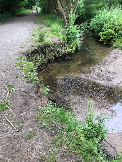
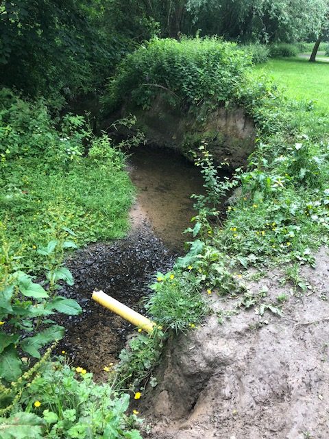
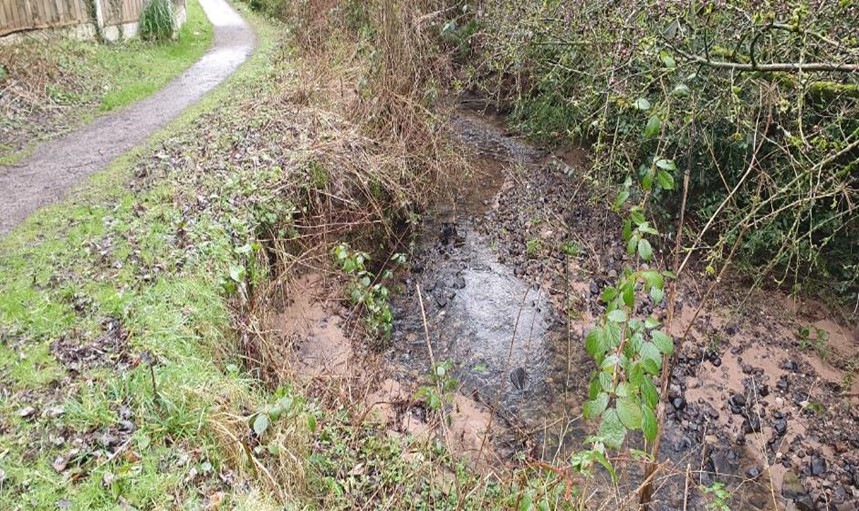
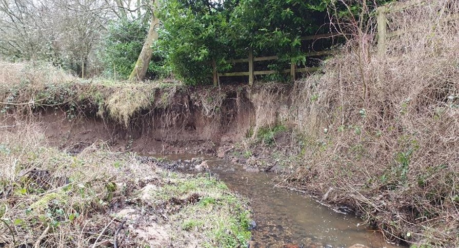
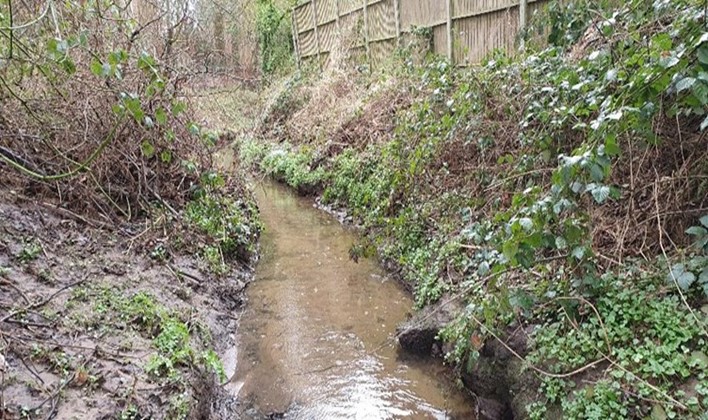
The project aims to prevent further bank erosion in six areas within the river corridor. All areas required green approaches to river engineering to prevent causing further damage to the park infrastructure and reduce the encroaching bank erosion onto neighbouring properties. These approaches favoured natural materials and living structures over synthetic materials and hard engineering.
Each erosion area required a different method of repair based on the severity, morphology and surrounding land use. Natural processes were used to encourage the stabilization of the eroding riverbank. Different methods of green engineering were adopted in each area, including locally sourced native hazel and willow creating more natural living structures in keeping with their surroundings.
CCNW Solution
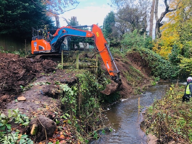
Site Clearance Works
CCNW’s Ecological Clerk of Works gave all CCNW’s operatives an Ecological Toolbox Talk before commencement. Overhanging branches were cut and trimmed, and thinning/coppicing works were undertaken to enable access along the sections of river banking.
Tree Harvesting:
CCNW’s tree team carried out thinning/coppicing works on hazel and willow, which were used in creating hazel and willow spilling and brushwood piles along the eroded sections of the river corridor. All woody materials were removed from the planted areas of woodland adjacent to Yarrow Valley Way by removing 1-4 trees within woodland blocks, leaving high-quality standard trees spaced no nearer than 4 meters apart. Additional willow coppicing works included Lower Burgh Meadows and Manor Road Allotments.
All works were carried out by qualified CCNW staff in a sympathetic way using thinning and coppicing methods carried out in the interests of the visual and habitat value of the sites.
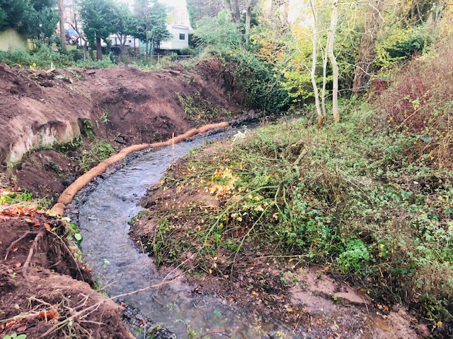
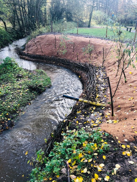
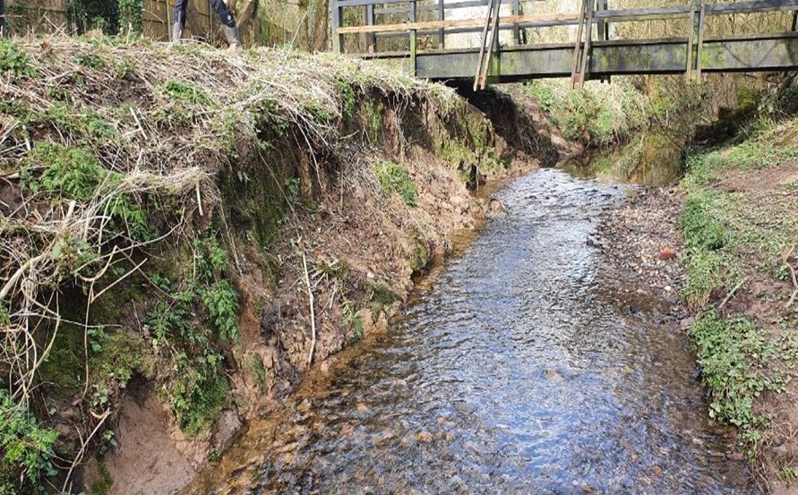
Erosion Area 1
The proposed works carried out on this section were by installing hazel spilling with live willow stakes along the right-hand side of the eroded banking for approx. 12 Lin meters. Installing these would protect the eroding toe and prevent further erosion.
The spilling comprised of hazel rods 25-50mm in diameter woven between chestnut stakes spaced at 0.5-meter spacing with every third stake using a live willow stake into the alignment of spilling at regular intervals to create retaining walls which hold the bank back.
The spilling was installed at a retained height of 200mm, above the height of the bank toe. The willow stakes inserted were approx. 75-100mm diameter. When willow grows into a dense root mat, it will bind the bank together so that it can withstand erosion from wave action.
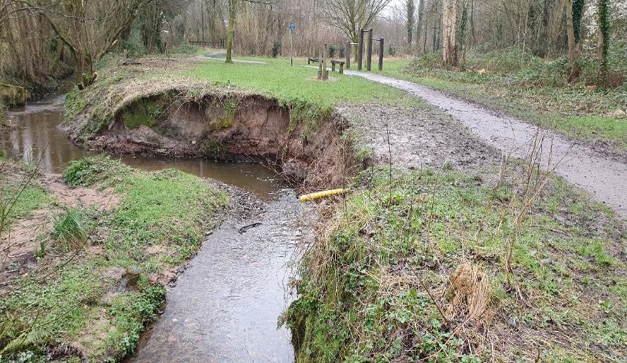
Erosion Area 2
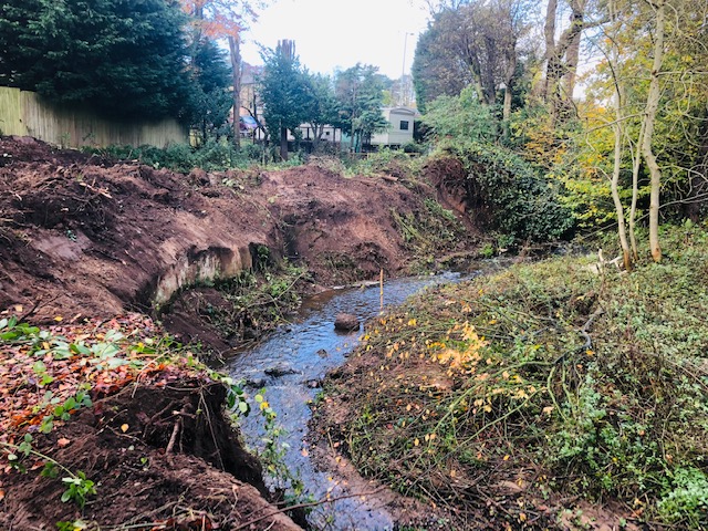
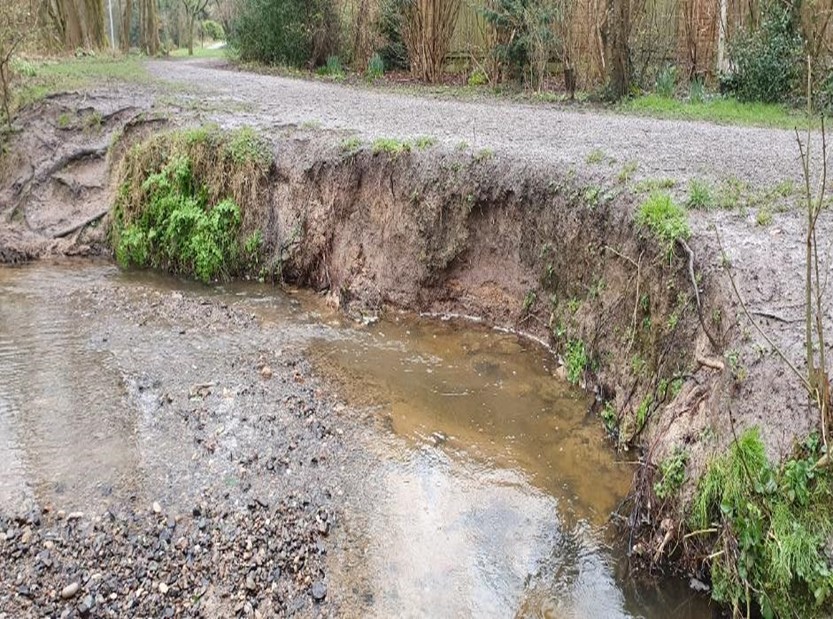
CCNW conservation team performed the site clearance works by felling the Cherry laurel, which was cut up and incorporated into backfill and brash wood bundles reused to protect the banking. The adjacent posts and rail fence were dismantled, and timber was incorporated into the backfill. Excavating, regrading, and then reprofiling the earth cliff from 0.8 -meters to an angle of no greater than 45° was achieved using a 13ton excavator. The existing turf was peeled back and re-laid over regraded slope where possible.
A single row of rock rolls, protecting double row of coir rolls, with a top row of pre-planted coir rolls, in a line on the right-hand banking, was installed following the natural curve of the river for approx. 30 Lin meters. The installation of two live willow brash bundles was then stacked behind coir rolls to a height of approx. 0.6- meters high. Chestnut stakes were driven into the riverbed on the river side of rock/coir rolls at 0.5-meter centres.
The regraded river banking was then covered with a biodegradable erosion protection matting, sown with a wildflower seed mix suitable for riverbank use. It was then secured into the ground using wooden T-pegs and live willow stakes planted within the matting.
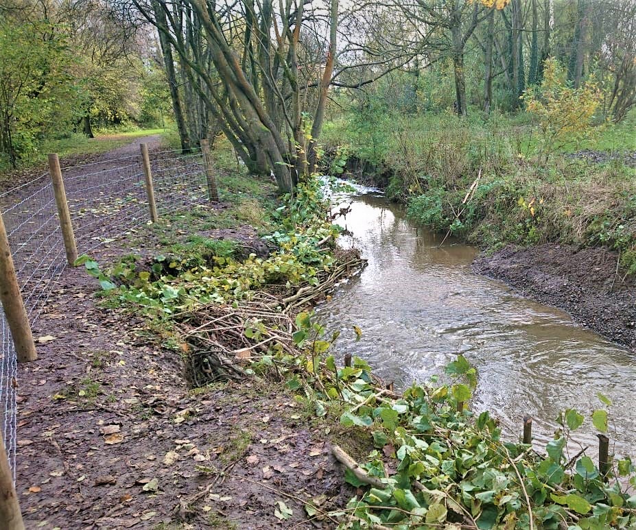
Erosion Area 3
The proposed works on this erosion section consisted of excavating, regrading, and then reprofiling the earth cliff from 0.6 -meters to an angle of no greater than 45° using a 13ton excavator. The existing turf was peeled back and re-laid over regraded slope where possible.
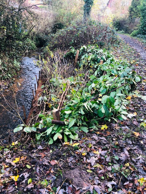
A single row of pre-planted coir rolls was installed for approx. 11Lin meters. Then Coir rolls were laid in an excavated trench within the riverbed approx. 150 mm deep, following the natural curve of the river. Behind this, two deadwood brash bundles composed of woody material from a local park were secured in place. Two rows of live willow brash bundles were stacked behind the coir rolls to a height of approx. 0.6 – meters secured with chestnut stakes and untreated posts, then sisal rope was woven between posts and chestnut stakes
The regraded river banking was then covered with a biodegradable erosion protection matting, sown with a wildflower seed mix suitable for riverbank use. It was then secured into the ground using wooden T-pegs and live willow stakes planted within the matting.
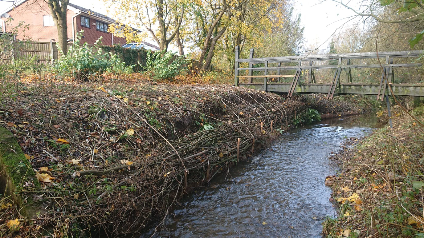
Erosion Area 4
On this erosion section, pre-planted coir rolls were installed for approx. 10Lin meters, laid along the toe of the eroding cliff, staked in place on the riverside with chestnut stakes. Unplanted coir rolls were used underneath the bridge and within 1 meter of the bridge.
The face of earth cliff was protected with deadwood brash bundles, secured by untreated posts driven into the riverbank at 0.8- meters from the edge of the cliff, using sisal rope which was woven between posts and chestnut stakes to secure the brash bundles. Live willow stakes were then planted in the lower half of eroding cliff or tight to the top of the brash bundles.
Erosion Area 5
The proposed works on this erosion section of banking involved the installation of live willow spiling (live rods woven around chestnut stakes) following the natural curve of the river for approx.8 Lin meters. The willow spiling was installed at 0.3- meters above water level.
Following the installation of the willow spiling untreated posts were driven into the riverbed tight to the foot of eroding banking to act as an anchor for securing brash bundles.
All spaces between the willow spiling and eroding bank were back filled with deadwood brash bundles, to approximately a linear gradient from the willow spiling to the top of the bank. Then sisal rope was woven over the brash bundles between the posts and the chestnut stakes to secure the brash bundles in place.
Erosion Area 6
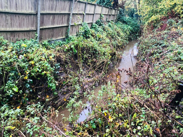
On erosion area 6, coir rolls were installed to form a new line river edge, for approx.8 Lin meters staked in place on the riverside with chestnut stakes driven into the riverbed at 0.5- meters centres.
Untreated posts were then driven into the riverbed tight to the foot of the eroding banking to act as an anchor and secure the brash bundles.
The spacing between the willow spiling and eroding bank was backfilled using deadwood brash bundles, to approximately a linear gradient from the coir roll to the top of the bank. Live willow poles were planted through the brash wood bundles into the river sediment shelf. Sisal rope was then woven over the brash bundles between the posts and the chestnut stakes to secure the brash bundles in place.
Special Features
Habitat improvement works
River-side project
Services
River Erosion Control
Green Engineering Bank Stabilisation using hazel and willow

Start a conversation with us today
If you wish to sign up to our quarterly newsletter, please fill out the subscription below.