Project
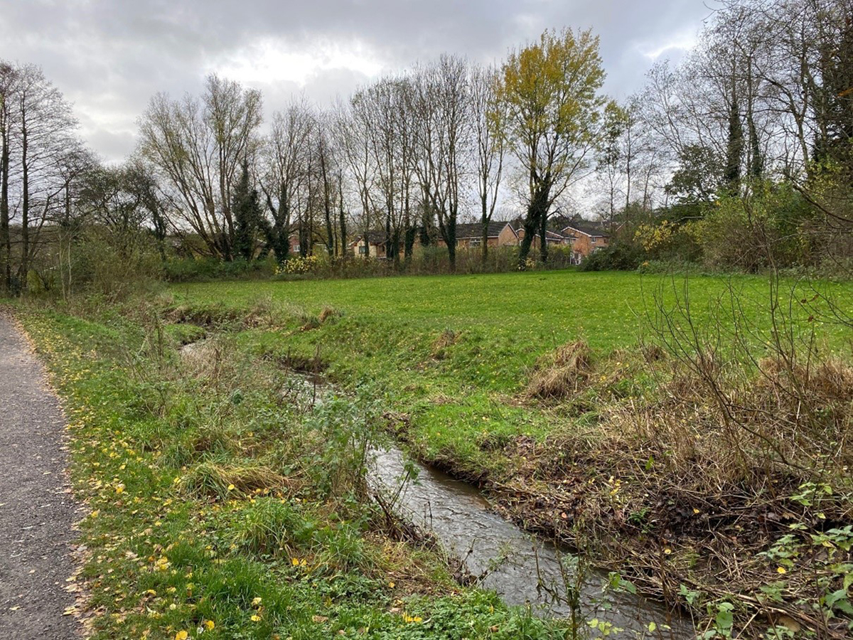
Carr Brook Linear Park
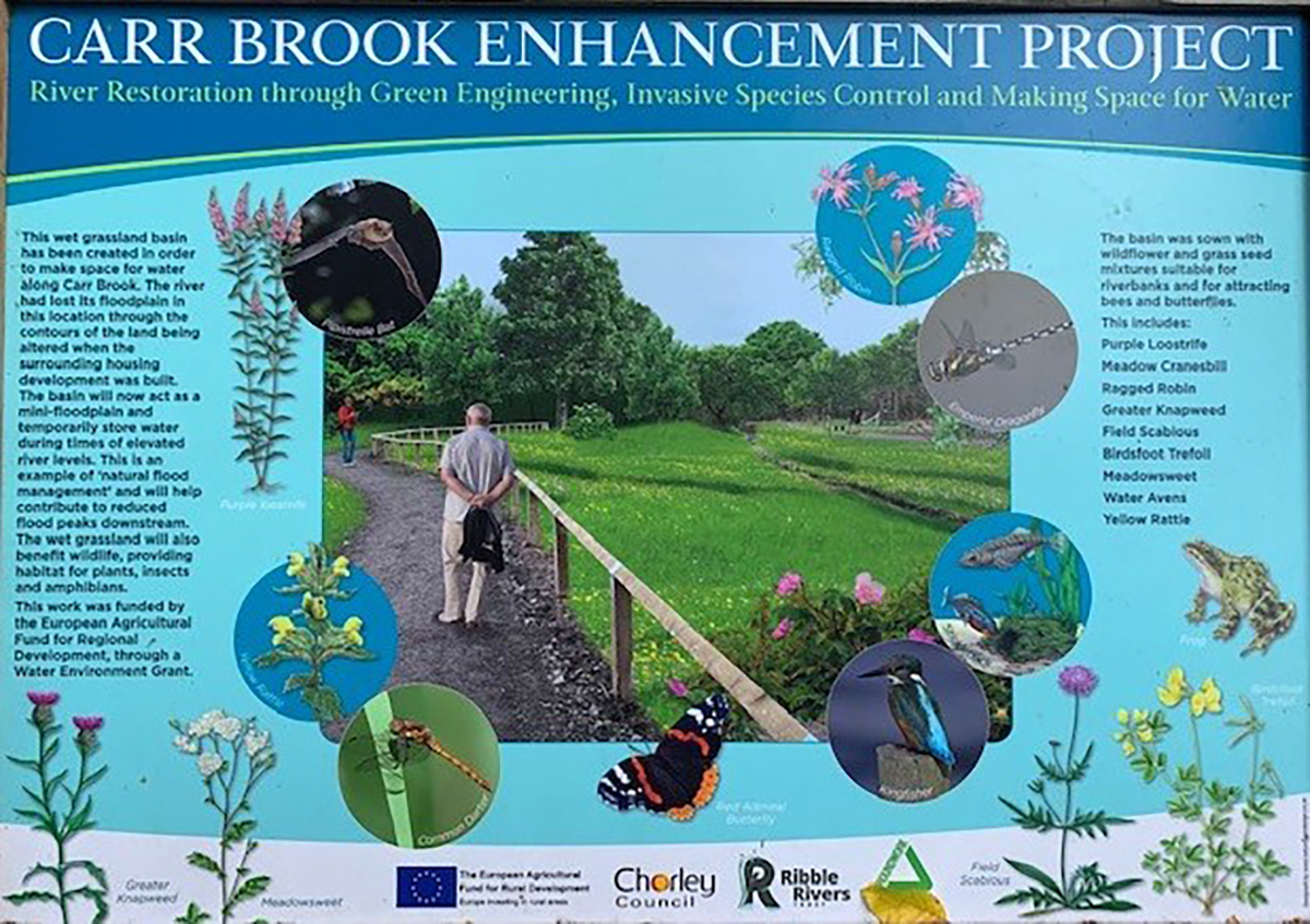
Natural Flood Management
Client: Chorley Council
Final Value: £30,000
Start Date: Mar 2022
Finish Date: Jun 2022
Background
This project was designed to create a Natural Flood Management (NFM) scheme for Carr Brook Linear Park.
Chorley Council received a Water Environment Grant (WEG) to investigate the feasibility of a Natural Flood Management/attenuation area with landscaping within the park open space to slow the river flow in times of heavy rainfall.
The agreed scheme was designed by a wetland designer using desktop and site base feasibility information, including EA Flood Risk data, trial pits and topographical data, to model and create a wetland to maximize water storage.
The project commenced after receiving planning permission from Chorley Council and a bespoke permit from the Environment Agency.
CCNW Solution
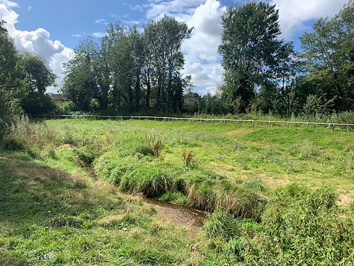
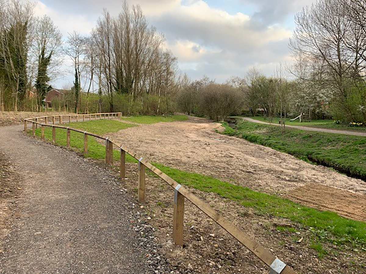
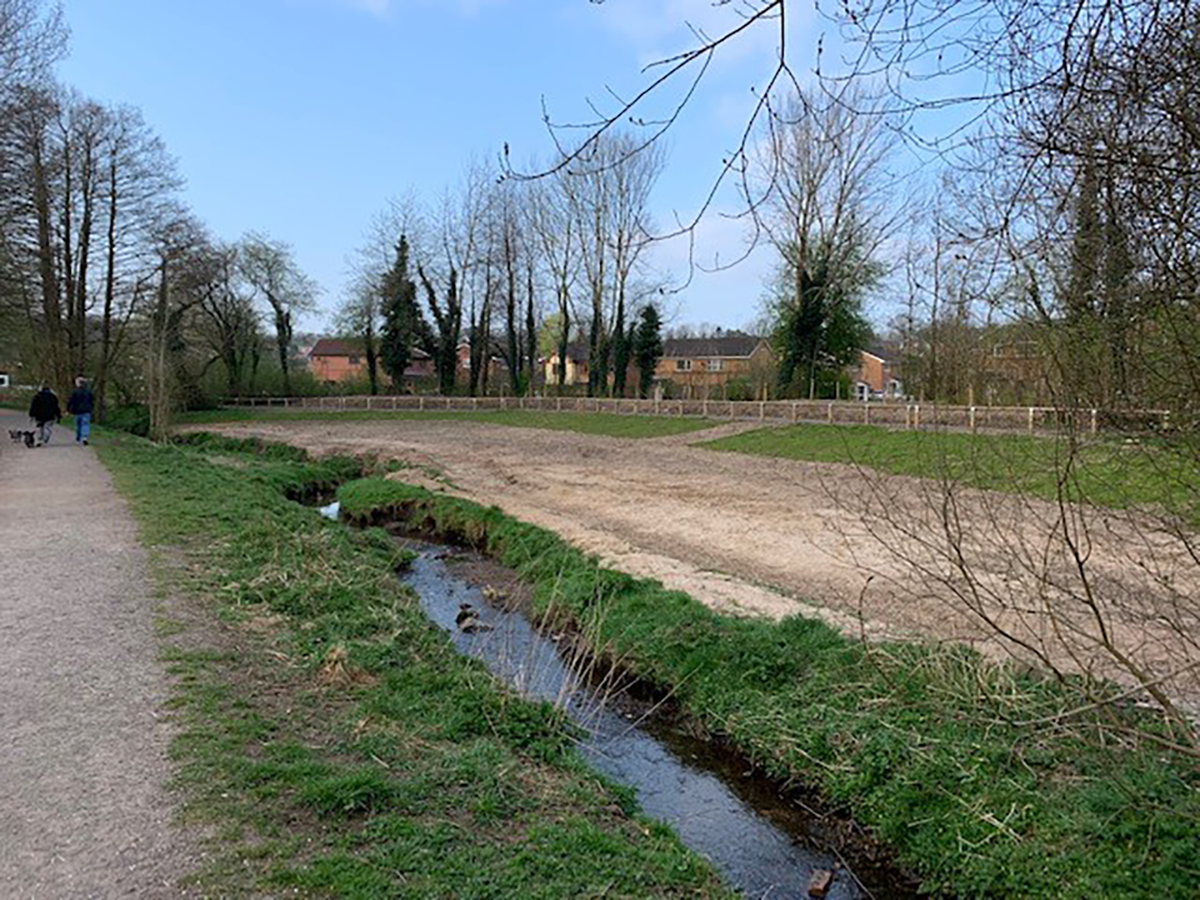
The NFM Scheme includes landscaping off Clover Field in Clayton-le-Woods on land 0.4ha in size. The flood plan area was 680 m3 of cut and fill with an inlet and outlet to Carr Brook. The scheme is designed to capture the discharge from the two storm drains near the site to benefit water quality and the wet grassland meadow creating new habitat for pollinators and amphibians.
The scheme is not intended to be a permanent wetland. It is designed not to hold water for long periods, but most of the time, it is to be a dry/wet grassland meadow. The NFM is created to hold back some water capacity preventing flooding further downstream. The water will then quickly drain away as the river flow goes back to the normal level, and for the majority of the time, it will look like a wildflower meadow and a wet grassland area.
Turf stripping from the cut and fill areas
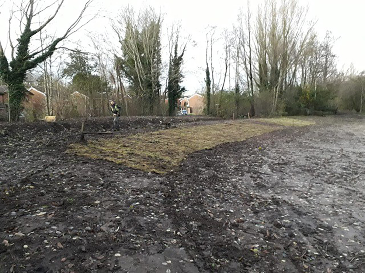
At the start of the works, all areas were marked out for the removal of the existing turf. The removal was carried out by turf stripping using turf cutters, removing the turf from the areas where the basin was to be excavated /cut and the area where all spoil was to be placed.
The cut turf was carefully placed and stored on-site for re-use in landscaping the finished works. Re-using the cut turf rolls would take less time to re-establish the grassland than using grass seed. The total area of the turf stripping was around 2500m2 (1300m2 fill area + 1200m2 basin area).
Stripping of topsoil from the area of the basin
The CCNW team then created a lower channel by excavating the existing landform beside the main river, which seasonally fills with river water in high flow/storm events. The excavated depth of the topsoil strip was around 200mm over and above the turf stripping.
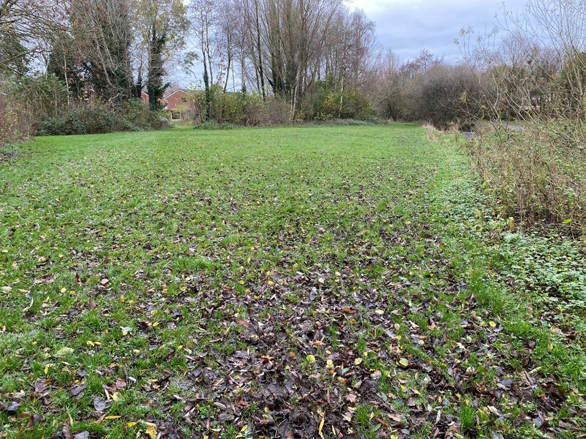
All excavated topsoil was retained on site and re-used in the design and construction of a new landform. The land levels to the far boundaries of the site within the existing amenity grassland area were raised by no more than 0.5m. This was to create an undulating landform that will be retained as grassed open space. The volume of material excavated was approx.240m3.
Chorley Council liaised with residents who live backing onto the proposed landform to agree on the exact locations and the finished height before construction works began.
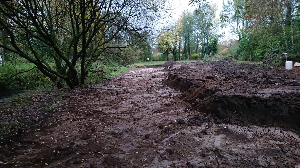
Bulk cut and fill
Our specialist team then excavated the basin to formation level for approx. 350mm above formation. The excavated volume of this cut and fill section of the project was approx.440m3. All excavated spoil was placed in the holding areas on site.
The slopes at the edge of the fill areas were created no greater than 1in 4. All of the in-filled areas were firmed into place by tracking over the finished profile with a 360-degree excavator.
Installation of temporary scour protection adjacent to surface water outfalls
CCNW supplied and installed heavy-duty Coir matting of 900g/square metre, pinned to cover the bare ground on the stream bank at each end of the new basin opposite each surface inlet and outlet to the stream. This was done to secure the side closest to the stream, achieved by hand-digging an anchor trench and then pinned using U pins along the length of the wetland basin.
Re-dressing the back-filled areas using topsoil and turf
The team completed the back-filling and dressing areas using the site-won topsoil from earlier activities. First, the excavated soil was re-used to form a bund around the newly created basin, then using the site won turf from the turf stripping activities; this was re-placed on the topsoil and firmed into place.
Re-dressing the sides of the new basin with topsoil and turf
The CCNW conservation team then completed the re-dressing of the sides of the new basin using the site-won topsoil. The sides, but not the base of the newly created basin was dressed in a shallow depth of 50mm of topsoil. Following this, the site won turf from the turf stripping activities was re-placed on the topsoil and firmed into place. This was achieved by manually positioning the turf by hand to ensure complete coverage of the sides of the new basin.
Preparation and seeding the base of the basin
The base of the wetland basin was scarified up using the toothed excavator bucket to reduce compaction and prepare the base for wet meadow seed. Topsoil was placed over this area and sown with a wet meadow mix at the appropriate rate as recommended by the supplier.
The Installation of a new bound gravel path
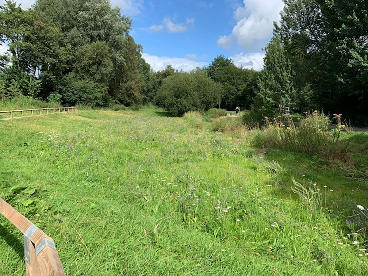
A new bound gravel path was installed using recycled aggregate.
The path was located around the edges of the NFM basin and through a small section of woodland, re-joining the existing path network and creating a circular route around the NFM basin and river.
The new path was constructed by scraping off the new alignment of path into a tray to a depth of 150mm by 1.5m wide, and the spoil was placed at the side of the path and spread out evenly. Then a Terram woven geotextile membrane sheeting was placed within the tray and back-filled and compacted using a recycled MOT Type 1 sub-base to a depth of 125mm along the entire length of the footpath. Finally, a wearing course of 4mm to dust was placed over the sub-base of recycled aggregate to a depth of 25mm.
Footpath and knee-high rail fencing
After the Natural Flood Management Scheme was completed, the CCNW team carried out the installation of 115m of bird’s mouth timber knee rail fence around the edge of the NFM basin.
Special Features
Flood management
Habitat improvement works
River-side project
Services
Wetland Basin Development
Grassland Wildflower Meadow
Footpath creation
Fence Installation
Start a conversation with us today
If you wish to sign up to our quarterly newsletter, please fill out the subscription below.